
The Siege of Vicksburg: Geography and a Union Victory

Silas Weaver
Silas Weaver has spent decades exploring historic battlefields, reading primary journals, and tracking down the lesser-known stories of the American Civil War. His lifelong passion for 19th-century history comes through in his engaging accounts of the places, people, and lingering questions of the era. He believes that walking the actual grounds where history happened is the best way to truly connect with the past.
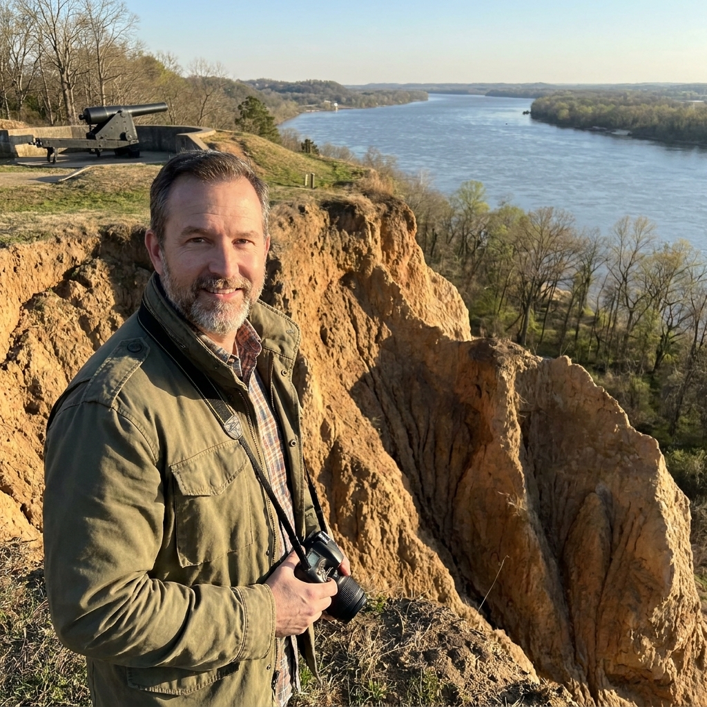
I have stood on Vicksburg’s heights in the early morning, when the Mississippi looks like a slow, polished sheet of metal and the city’s bluffs throw long shadows down toward the water. Up there, with the river laid out like a highway and the low country to the east sitting heavy and green, it becomes easier to understand why people sometimes called this place the “Gibraltar of the Confederacy.”
Vicksburg did not become a legend because of one clever plan or one dramatic charge. It became a legend because the ground itself seemed to take sides. The bluffs, the river, and the swamps gave the Confederates a natural fortress. In the end, those same features helped trap the city inside its own strength, until hunger and exhaustion did what assaults could not.
Why Vicksburg mattered
By 1863, the Mississippi River was more than a line on a map. It was the central artery of the continent. Control it, and you could move men, food, and ammunition faster than any wagon road allowed. Lose it, and you risk cutting your own country in half.
Vicksburg sat on a sharp bend of the river, where traffic was pulled close beneath high bluffs. A city perched above that bend could threaten any ship trying to pass, and could also serve as a gate between the Confederate states east of the river and those to the west. That is why Ulysses S. Grant kept coming back to Vicksburg after earlier attempts failed. The war in the West could not truly be settled while this high ground still bristled with Confederate guns.
If you want a broader refresher on how campaigns and major actions fit together, our guide to Civil War battles is a good place to orient yourself before diving back into the ravines and redoubts.
The bluffs
The first thing geography did for Vicksburg was simple: it made the city hard to hit from the water and hard to take against its river-facing defenses.
Vicksburg rises abruptly from the Mississippi. Those steep bluffs were not just scenic overlooks. They were defensive platforms. Artillery placed high could fire down on passing vessels, forcing Union gunboats and transports to endure plunging shot and shell. The river might have been the Union’s highway, but near Vicksburg it ran under a set of cliffs that could bite.
For an attacking army, the bluffs meant this: a direct approach from the river side was punishing. Assault troops had to climb under fire, often through broken ground that disrupted formations. Even apart from the man-made defenses, the terrain forced men into narrow approaches and exposed them on the slopes.
Swamps and bayous
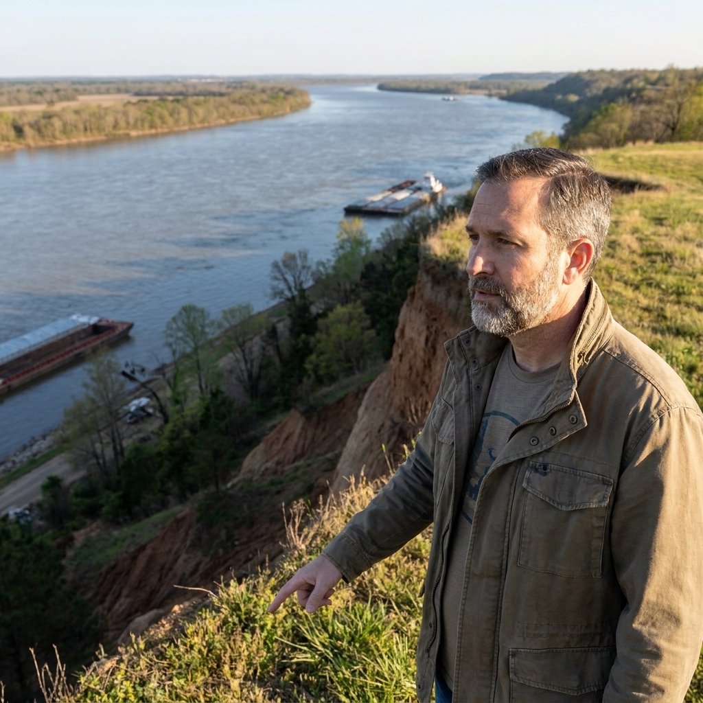
To the east and north of Vicksburg lay a mess of low ground: swamps, bayous, and backwaters tied to the river’s moods. This country did not stop armies completely, but it slowed them, sickened them, and limited where they could go.
In practical terms, that terrain did three things for the defense:
- It funneled movement. Roads and dry ridges mattered because everything else could turn into mud or waterlogged ground. If you had to attack, you often had to do it where the land allowed, not where you preferred.
- It complicated supply. Wagons bogged down. Animals struggled. What looked close on a map could feel very far in a humid bottomland.
- It bought time. The more an army had to feel its way forward, the more time defenders had to strengthen fortifications and shift troops.
Vicksburg’s position meant the Union could not simply “surround” the city the way we might imagine with a neat ring on a modern diagram. To seal it off, Grant had to solve a puzzle made of ridges, creeks, ravines, and mucky lowlands, then keep solving it day after day while men sweated in trenches.
Ravines and ridges
Once Grant’s army got in behind Vicksburg after the inland campaign that followed his move south of the city, the landscape around the defenses revealed another ugly truth: it was tailor made for digging in.
The approaches to Vicksburg were cut by steep ravines and irregular ridges. That broken terrain gave defenders countless ready-made angles for fieldworks. It also meant Union assaults had to cross gullies, climb abrupt slopes, and reform under fire. Coordinating multiple brigades across such ground is hard in the best conditions. Under musketry and artillery, it becomes close to impossible.
Grant tried major assaults on May 19 and May 22. They were brave, and they were bloody. The terrain helped make sure of that. When those attacks failed, siege operations were not just a choice. They were the sane answer to a landscape that punished frontal heroics.
If you have ever traced how trenches changed a battlefield from open maneuver to grim geometry, you will recognize the pattern from later war sites too. Our piece on the trenches of Petersburg shows what that evolution looked like when earthworks became the main event rather than the supporting cast.
The Mississippi River
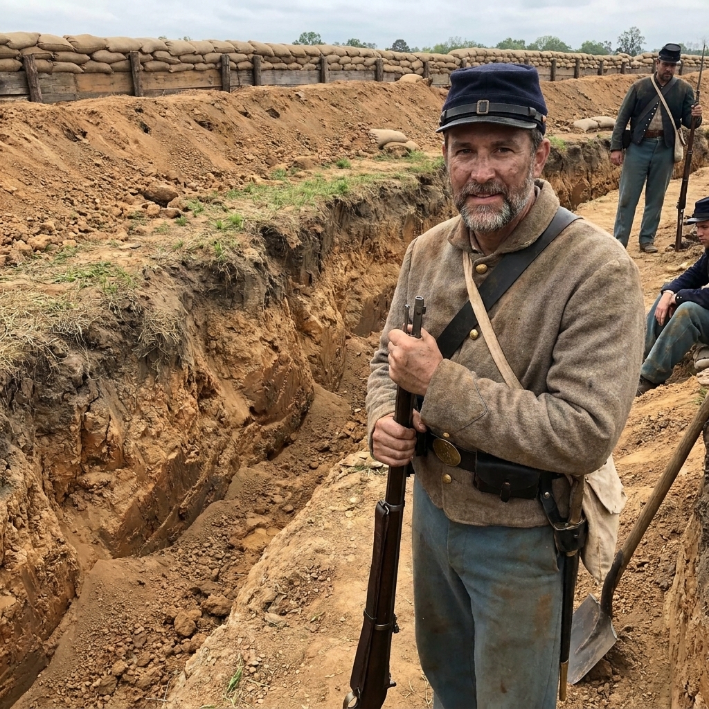
It feels almost unfair to call the Mississippi a “feature” in the same way we call bluffs or swamps features. The river was a living force that shaped every decision.
Early in the campaign, the river corridor and west-bank connections offered the Confederates a way to communicate and coordinate with forces across in Louisiana. But once Grant invested the city and Union naval power tightened its grip, the same water that made Vicksburg powerful also made it vulnerable to isolation. A fortress on a river is only as strong as its ability to receive food and ammunition.
As Union control of the river and the surrounding approaches increased, Vicksburg’s strongest advantage became a kind of enclosure. With difficult lowlands and broken ground around the city, and Union lines pressing closer, relief and breakout efforts were made difficult in the extreme. Geography helped Grant do what every besieger wants: close the doors and keep them closed.
Hunger and shelter
The grim heart of the Vicksburg story is not the cannonade. It is the slow arithmetic of calories.
As the siege tightened, civilians and soldiers moved into caves dug into hillsides, seeking safety from shells that came in day after day. With the city cut off, rations dwindled. Mule meat became a reality rather than a rumor. Foraging became desperation. What made Vicksburg “impregnable” also made it hard to relieve once it was closely encircled. The same cliffs and broken ground that had helped the defenders repel assaults now helped the besiegers hold them in place.
When you read about hunger in besieged places, it is easy to treat it like a footnote. I try not to. Hunger is not abstract. It changes how people walk, how they speak, and how they hope. If you want context for what soldiers were supposed to live on before shortages and siege conditions upended everything, see our breakdown of Civil War soldier rations.
Grant and the terrain
It is tempting to talk about Vicksburg as if geography did all the work by itself. It did not. The landscape created the conditions, but an army still had to exploit them.
Grant’s operational success in 1863 came from embracing the hard truth that Vicksburg could not be taken like a conventional city assault. Union forces got below the guns, crossed to the Mississippi side south of the city, then fought inland and turned back toward Vicksburg from the east. That shift made the bluff-top fortress less useful, because the decisive contest moved to the ravines, ridges, and roads behind it.
From there, he aimed to:
- Get behind the fortress. Vicksburg’s river-facing strength mattered less once the Union army established itself on the inland approaches.
- Cut lines of communication. Every road and path that led into the city became a target for control, harassment, or closure.
- Dig closer, day by day. Siege warfare is slow and methodical. On Vicksburg’s broken ground, it was also practical, letting Union troops reduce exposure while tightening the ring.
The story, in other words, is not only that Vicksburg had steep bluffs and swamps. It is that Grant treated that terrain like a set of tools. Some tools were blunt, like encirclement. Some were delicate, like saps and approaches. But they all served one goal: make the fortress feed itself until it could not.
Surrender on July 4
On July 4, 1863, Vicksburg surrendered. It is one of those dates that sticks in the throat because it lands on the nation’s birthday, and because it came just a day after Gettysburg’s fighting ended. Two very different landscapes, two very different kinds of warfare, and together they signaled that the war’s center of gravity was shifting.
At Vicksburg, geography had shaped every chapter: the bluff-top guns that made the city dangerous, the swamps that complicated approaches, the ravines that favored defenders, and the river that turned from lifeline into noose. The Union victory did not come from making the fortress less strong. It came from making its strength irrelevant by cutting it off from the world.
And the result mattered far beyond the bluffs. With Vicksburg in Union hands, the Mississippi was effectively opened to Union traffic, and the Confederacy’s trans-Mississippi region was more firmly cut off from the east.
If you visit
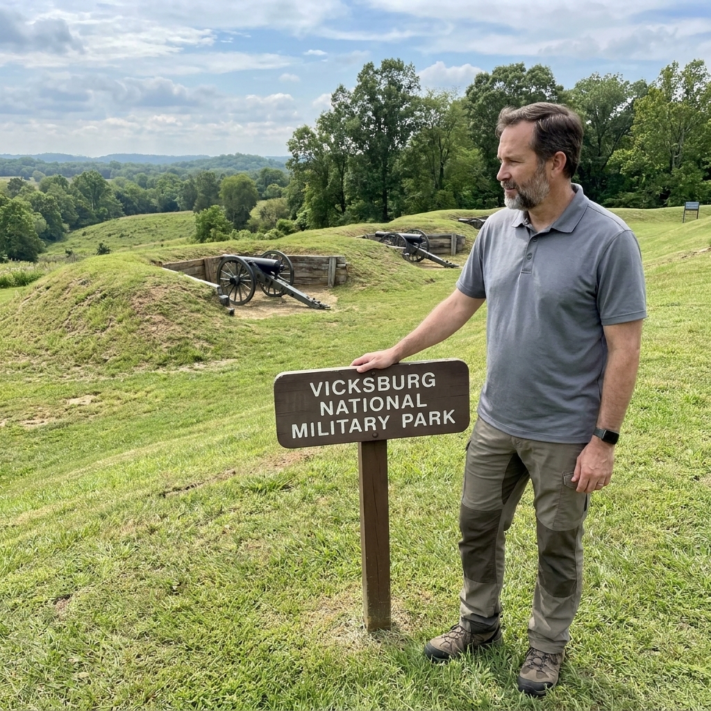
Whenever I walk a battlefield, I try to spend a few minutes doing nothing at all. No reading. No phone. Just letting the contours explain themselves. Vicksburg rewards that kind of silence.
- Look out from the heights. Feel how commanding the river view is, and imagine trying to run a gauntlet beneath it.
- Notice how quickly the land breaks up. Ravines appear where you least expect them. That is the sort of terrain that turns “advance” into “struggle.”
- Think about supply. Ask yourself where food would come from, where it could enter, and what happens when every answer is “it cannot.”
If you are planning any battlefield stop with limited time, our battlefield day planning guide can help you build a visit around a few high-value overlooks and walking paths, instead of trying to see everything and absorbing nothing.
In one sentence
Vicksburg fell because the same geography that made it look untouchable also made it possible to seal it off, and once sealed off, a fortress becomes a pantry with the door locked.