
Tracing an Ancestor at Shiloh

Silas Weaver
Silas Weaver has spent decades exploring historic battlefields, reading primary journals, and tracking down the lesser-known stories of the American Civil War. His lifelong passion for 19th-century history comes through in his engaging accounts of the places, people, and lingering questions of the era. He believes that walking the actual grounds where history happened is the best way to truly connect with the past.
The first time I tried to “find” a single regiment at Shiloh, I did what most of us do. I drove straight to the Hornet’s Nest, stood there in the shade, and tried to imagine my way into the smoke. It felt powerful, but also slippery. Shiloh is big, wooded, and full of overlapping lines. If you want to trace an ancestor’s footsteps, you need something sturdier than imagination. You need unit names, times of day, and a map you can hold up to the landscape.
This guide is the method I use now: start with the soldier’s exact unit, read the regiment’s paper trail (especially after-action reports as printed in the Official Records), then “walk the text” on the park roads with Shiloh’s battlefield maps. You may not get to a single tree stump, but you can usually narrow your ancestor’s Shiloh down to a specific ridge, field edge, battery position, or stretch of ravine.
Start with the unit
At Shiloh, the key is not your ancestor’s name. The key is their unit and where that unit was assigned during April 6 and 7, 1862.
The minimum you need
- Side: Union or Confederate
- Unit down to company: for example, Company C, 12th Iowa Infantry or Company H, 6th Mississippi Infantry
- State (if you only have a number): “12th Infantry” could mean several different regiments until you pin down “Iowa,” “Illinois,” and so on
- Higher organization if possible: brigade, division, corps (these can change during the battle, but they give you a starting lane)
If you are still working out the unit, the fastest path is usually the soldier’s compiled service record or pension file. Once you have the regiment, you can often reconstruct the rest from the after-action reports.
If letters are all you have, learn how to squeeze them for clues. I have a whole approach to that in Decoding Civil War Soldier Letters.
If you do not know the unit yet
Sometimes you arrive at Shiloh with a name and a family story, and not much else. When that happens, I work from the outside in, looking for anything that ties the person to a specific regiment.
- Gravestones and obituaries: veterans are often listed with a regiment and company, sometimes with a corps badge or a post-war organization that hints at the unit.
- Census and county histories: not always precise, but they can narrow a regiment list in a particular county.
- State rosters and adjutant general lists: once you have a likely state, these can help you match a name to the right numbered regiment.
Even a partial clue helps. “12th Infantry” plus a home county can be enough to land on the correct 12th from that state, and from there Shiloh gets much easier to map.
Bring a map-and-sources kit
When you get serious about a single regiment, you end up juggling three kinds of sources. Each has blind spots, and that is why they work best as a set.
1) Regimental history
Regimental histories can be wonderfully detailed, or frustratingly patriotic and vague. Either way, they often include:
- a march route into the battlefield
- which brigade they were in at Shiloh
- landmarks soldiers remembered (sunken roads, peach orchard, crossroads, ravines)
- casualty lists that hint at how hard they were hit and when
Use the regimental history as your narrative spine, but do not stop there.
2) The Official Records (after-action reports)
If I could only bring one written source to Shiloh, it would be the after-action reports in the War of the Rebellion: Official Records. Reports are imperfect, but they are often specific about sequence and neighbors. Phrases like “on my right was” and “advanced across the field into the timber” are gold.
For Shiloh, you will most often be living in Series I (the campaign and battle reports), and many readers focus on Series I, Volume 10, where Shiloh material appears. You can read the Official Records online through Cornell’s Making of America collection: https://collections.library.cornell.edu/moa_new/waro.html.
3) Shiloh National Military Park maps
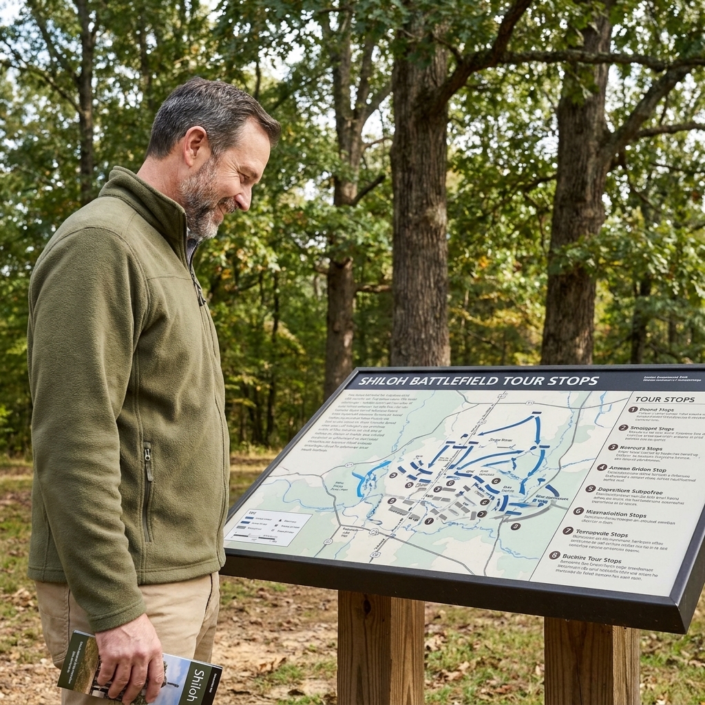
You want the park’s battlefield tour materials and any map the visitor center provides, plus a modern road map of the park. The battle lines at Shiloh are easiest to understand when you can physically connect a report’s “left of the road to Corinth” to a real bend in a real road.
Before you go, take five minutes and skim our general planning advice in Plan a Civil War Battlefield Day. Shiloh rewards a full day, especially if you are trying to verify a unit’s movement rather than just see the greatest hits.
Make a one-page unit dossier
This is the part that feels almost too simple, but it keeps you from getting lost in the weeds. Make a single-page summary you can hold in your hand at a tour stop.
What to put on the page
- Unit: regiment and company (if known)
- Command chain at Shiloh: brigade, division, corps, army
- Primary quotes: 3 to 6 short excerpts from reports that mention a place, a road, a field edge, a landmark, or another unit
- Time cues: “at daylight,” “about 9 a.m.,” “late afternoon,” “after dark”
- Neighbors: units named on the left and right
Do not worry about perfect timestamps. At Shiloh, “mid-morning” is often as close as the sources honestly allow.
Match 1862 wording to terrain
The hardest part for most visitors is realizing that soldiers did not always use the place names we use today, and not consistently. Your ancestor’s report might not say “Hornet’s Nest” or “Bloody Pond.” It might say “near the peach orchard” or “along the road to Pittsburg Landing.”
Common landmarks in reports
- Road to Corinth (often “Corinth road”): a major reference line for Confederate advances and Union fallbacks, though naming varies by writer
- Hamburg-Purdy Road: another frequent boundary in descriptions
- Pittsburg Landing Road: often called simply “the road to the Landing”
- Shiloh Church: sometimes written as Shiloh Meeting House or “the log church,” an early focal point on April 6
- Ravines and branches: mentioned constantly because they broke formations and hid troops
- Fields and clearings: often identified by a nearby cabin or by “open ground” versus “timber”
When you read “advanced through timber into an open field,” stop and ask: which field? That is where the map work comes in.
Use left-right-near
Here is the most reliable trick I know for locating a regiment at Shiloh when the text feels vague. You triangulate using three kinds of statements.
Step 1: Collect left and right neighbors
In reports, officers constantly note who supported them or who aligned with their flank. If your ancestor’s regiment is described as “on the left of the 17th” or “supported by Smith’s battery,” write that down.
Step 2: Collect near landmarks
Look for any physical references: a church, a road, a bridge, a ravine, a cabin, “the enemy’s battery,” “a field,” or “the crest of a ridge.” Even “a swampy branch” can be meaningful at Shiloh.
Step 3: Match all three on the map
On the battlefield map, find where those neighbors are known to have been. Then see where a regiment could plausibly fit while still being “near” the landmark mentioned. You are not hunting a dot. You are finding a slice of ground that satisfies the relationships described.
This approach also helps you catch a common pitfall: some regiments fought in more than one distinct place at Shiloh, especially if they were shifted to plug gaps. If the left-right-near set changes, you might be looking at a second phase of the fight.
Remember detachments happen
Even when you can place a regiment, do not assume every company stood shoulder-to-shoulder in one neat line all day. Companies can be pushed out as skirmishers, sent to support a battery, or pulled into a mixed line during a crisis. So when I say “your regiment was here,” what I usually mean is: this is the best-fit ground for the regiment’s main body during that phase of the battle.
Walk Shiloh by time blocks
The driving tour is helpful, but for ancestor work, I prefer time blocks. Shiloh is essentially two long, brutal days with very different rhythms.
April 6: rolling, collapsing lines
Sunday tends to be described in waves. A regiment may start near its camp, move forward to meet the attack, fall back to a new ridge, and then make a stand near a road. For April 6, your main goal is to establish:
- where the regiment was surprised (or first engaged)
- where it made its longest stand
- where it ended the day (and whether it was still organized)
April 7: grinding advance
Monday often reads like a push-and-pause rhythm, with lines advancing over ground fought over the day before. For April 7, focus on:
- the axis of advance (which road or general direction)
- which Confederate line or position they pressed
- where they were when the battle ended
On the ground, I like to park, walk a short stretch, and read the relevant excerpt right there. If you have never tried this, it changes everything. A sentence like “crossed the ravine and dressed on the colors” suddenly has weight when you are staring into the cut of that ravine.
Do not force famous names
Many visitors want to connect an ancestor to a famous place name. That is understandable. But Shiloh’s famous places were magnets, and units passed through them at different times. Make sure your sources really support the match.
Shiloh Church
If your unit’s reports mention Shiloh Meeting House, Shiloh Church, or “the log church,” that is a strong anchor. If they do not, do not force it. Plenty of troops fought hard within a mile or two and never touched that ground.
Hornet’s Nest and the Sunken Road
Some reports will mention a “sunken road,” “a deep road,” or a stubborn position in timber. That can point you toward the Hornet’s Nest area, but it can also be another cut road or defensive wrinkle. Confirm it using neighbors, artillery references, and whether the unit describes being enveloped and forced out late in the day.
Peach Orchard
“Peach orchard” shows up frequently, but men also used the phrase loosely for any orchard. The true Shiloh Peach Orchard area has a particular feel on the ground. It sits in a zone where lines shifted repeatedly. Again, the neighbor method keeps you honest.
Pittsburg Landing
Units that ended April 6 near the Landing often describe artillery massing, gunboats firing, or the crush of disorganized troops. If your regiment’s account mentions those, the terrain around the Landing will start to line up quickly.
Common map pitfalls
- Tree lines lie: today’s woods and the 1862 pattern of fields and timber do not always match. Use the maps and the contours more than the modern edge of a treeline.
- Road names shift: reports may describe “the road to the Landing” or “the road to Corinth” rather than the exact labels you see today. Treat road references as general axes unless the text gives a junction or a landmark.
- Markers are clues, not proof: commemorative tablets are useful, but your unit’s position still needs to agree with the report language and the neighbor units.
When the history is vague
Some regimental histories are precise down to fence lines. Others read like a toast at a reunion. If your unit’s narrative is fuzzy, you still have options.
Use brigade and division reports
If the regimental report is thin, read the brigade commander’s report, then the division commander’s. Higher commanders often mention where each regiment was placed, especially when describing forming a line or making an assault.
Use casualty timing
If you can identify when the regiment took its heaviest losses, that can narrow where it was. A unit that gets shredded at midday on April 6 is often in a different sector than one that does not get heavily engaged until late afternoon. Be careful though. Casualties can spike during a retreat as well.
Use attached guns
Artillery batteries, especially, tend to have clearer location references. If a report says the regiment supported a named battery, find the battery’s report and work backward.
A field routine
Here is the routine I follow when I am trying to place a specific regiment at Shiloh without spinning my wheels.
- Morning at the visitor center: get the current park map, ask what roads or trails are closed, and note any ranger programs that cover your unit’s sector.
- First drive-through: do one slow loop to orient yourself to the roads and distances.
- Two focused stops: choose the best anchor points you have (a road junction, Shiloh Church, a known battery position), then read your excerpts on site.
- One short walk: pick one area where the text mentions timber, ravines, or an advance across open ground and walk just enough to feel the terrain.
- End-of-day check: re-read your dossier page and adjust your “most likely” positions for April 6 and April 7.
If you are traveling more broadly and building your skills at reading battlefields, our Battlefield Travel guide pulls together the habits that make this kind of trip smoother.
Respect the limits
Even with good sources, you are rarely proving your ancestor stood on a particular square yard at 2:10 p.m. What you can often do is something almost as meaningful: identify the ground their regiment fought over, the direction they faced, what they were trying to do, and how the terrain shaped their fear and their courage.
When you get to that point, you will notice Shiloh changing on you. A gentle ridge becomes a line of survival. A ravine becomes a trap. A quiet stand of trees becomes the place where the regiment’s world narrowed to smoke, shouted orders, and the hard work of staying in line.
Quick FAQ
Can I trace a Confederate unit at Shiloh the same way?
Yes. The method is identical: regiment, command chain, after-action reports in the Official Records, then map and terrain. In my reading, Confederate reports can be just as detailed, and they are often candid about confusion and lost direction in the woods.
What if my ancestor was a cavalryman or artilleryman?
Artillery is often easier to place because batteries mention roads, ridges, and fields they needed for line of sight. Cavalry at Shiloh can be trickier because elements were used on flanks, for reconnaissance, or were engaged away from the most visited areas. Start with the battery or cavalry regiment report, then move up to brigade reports.
How do I keep kids interested while doing unit detective work?
Give them a single mission, not the whole puzzle. Let them be the “map checker” who finds the road names, or the “quote reader” who reads the next excerpt at each stop. I put more ideas into How to Keep Kids Engaged on a Civil War Battlefield Trip.