Sherman’s March to the Sea: Key Stops Today

Silas Weaver
Silas Weaver has spent decades exploring historic battlefields, reading primary journals, and tracking down the lesser-known stories of the American Civil War. His lifelong passion for 19th-century history comes through in his engaging accounts of the places, people, and lingering questions of the era. He believes that walking the actual grounds where history happened is the best way to truly connect with the past.
There is a certain chill that settles in when you stand on ground that once fed an army on the move. Sherman’s March to the Sea is often summarized with one hard phrase, “total war,” but historians argue over that label. Many prefer “hard war” or “war of destruction,” because the march was aimed at breaking Confederate logistics and morale, not annihilating the whole society the way 20th-century total war would. Either way, the deeper truth is written in small places. A depot platform where corn was loaded. A courthouse square where news arrived in a single sheet. A stretch of red clay road where men walked day after day, living on what they could gather, leaving a wake that Georgians remembered for generations.
This is a travel-friendly route through the campaign, built for modern roads and modern time constraints. It is not every marker and not every mile. It is a set of stops that, taken together, helps you feel how Sherman’s army moved, why it moved the way it did, and what it meant when it passed through.
If you want more general tips for making a battlefield day run smoothly, I keep my basics here: Plan a Civil War Battlefield Day.
Before you go: what you are tracing
Sherman left Atlanta in mid-November 1864 with about 60,000 to 65,000 troops in the main marching columns, depending on how you count supporting arms and the cavalry moving on the flanks. The army advanced in two primary wings: Oliver O. Howard’s right wing (often called the Army of the Tennessee) and Henry W. Slocum’s left wing (often called the Army of Georgia). Cavalry under Judson Kilpatrick ranged out ahead and to the sides, and foragers were in constant motion.
The point was not a single decisive battle. It was to cut loose from a supply line, live off Georgia’s interior, and strike the Confederacy’s ability and will to wage war. Railroads were bent, depots burned, bridges dropped into creeks, and food stores seized or destroyed. Enslaved people made impossible choices, often trying to follow the columns toward freedom.
Two quick reminders that make the landscape make sense:
- The route was broad. The army moved in parallel columns, not a single snake-like line. Many towns experienced raiders and foragers without ever seeing Sherman himself.
- Railroads were the campaign’s nerve endings. When you can see the rail corridors, you can see why certain towns mattered.
Stop 1: Atlanta
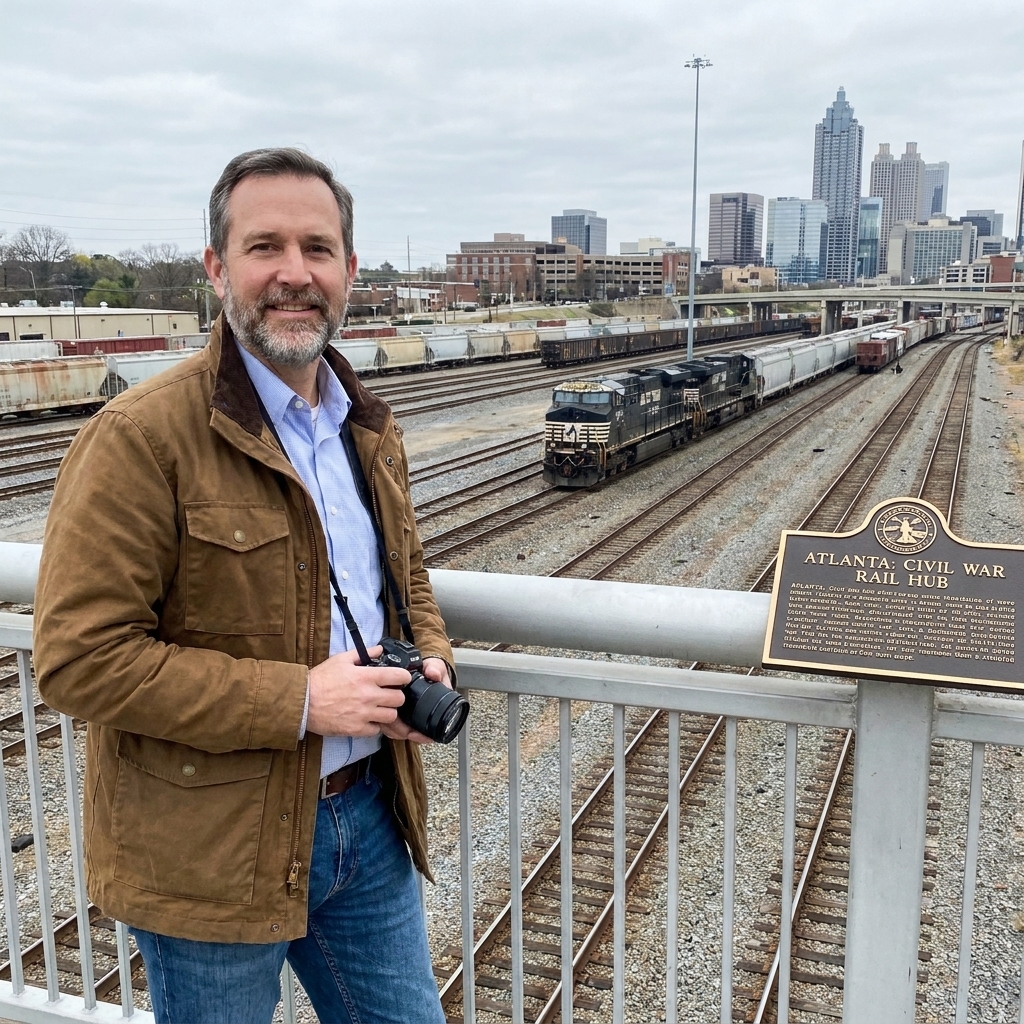
If you start anywhere, start in Atlanta, because the march is easier to grasp when you first absorb what Atlanta represented in 1864: a rail hub, a supply and repair center, and a symbol. The city’s fall and the later destruction of military assets were inseparable from the logic of the campaign.
Practical pacing: Atlanta is a good first-night base if you are starting fresh, because you can do context in the afternoon and still be rested for the long eastward push.
What to look for today:
- Rail geography. Even when tracks are modernized, pay attention to corridors and junctions. Sherman’s war in Georgia is a railroad story as much as a marching story.
- The Atlanta Campaign context. The march did not appear out of thin air. If you have time, it helps to anchor the story with a few Atlanta Campaign sites and monuments first. I have a handy starting point here: 10 Striking Atlanta Campaign Monuments.
On-the-ground tip: In your mind’s eye, try to replace the traffic with wagon trains. The clatter of modern Atlanta can actually help you imagine the noise and congestion that a departing army created.
Stop 2: East of Atlanta
As the army pushed out of Atlanta, it spread into a wide front. You will not find a single “march trail” you can walk end to end, but you can still visit places where the distance from Atlanta suddenly becomes real. The communities east of the city are a good place to make that mental shift from siege warfare to movement warfare.
Practical pacing: This is a good half-day stretch on Day 1 before you settle farther east for the night.
What to watch for:
- Road alignments. In Georgia, old roads often survive as modern routes that bend around creeks and ridges the same way they did in the 1860s.
- Small-town squares. These were information nodes. News, rumors, requisitions, and fear all flowed through them.
On-the-ground tip: When you hit a two-lane road that runs straight for a while, pull into a safe turnout and listen. The march was loud. A moving column is wagons, animals, shouted orders, and thousands of feet. Quiet scenery can mislead you unless you actively supply the sound.
Stop 3: Madison

Madison is often wrapped in the story that it was spared because of its beauty, or because an officer admired it, or because of a Masonic connection. Like many good Civil War legends, it contains a hint of truth and a lot of varnish. The real value of stopping in Madison is not to chase a single neat explanation, but to confront how memory works. People needed reasons for why one place burned and another did not.
One checkable anchor that helps you sort legend from logistics is this: Madison did not sit on the main rail spine Sherman was trying to cripple, the way towns like Milledgeville and points farther east did. That did not mean the area was untouched. Foraging and disruption still reached out into the countryside, and not every story of a “spared town” survives close inspection.
When you visit, ask yourself two questions:
- What military value did the town have? Warehouses, rail access, bridges, and storehouses mattered more than aesthetics.
- What does the town preserve, and what does it emphasize? Historic districts can be wonderful, but they also select what survives.
Practical pacing: Madison makes a comfortable overnight anchor between Atlanta and Milledgeville if you want to avoid doing too much driving after dark.
Stop 4: Milledgeville
Milledgeville is one of the most illuminating stops on the entire route. In 1864 it was the state capital, and Sherman’s men arrived with the kind of confidence you only see in an army that knows it has the initiative.
Here, the campaign’s political message comes into focus: this was not just an army passing through. It was an army demonstrating that Confederate state power could be reached, occupied, and publicly humbled. If you visit local interpretation, you will almost certainly hear about the statehouse and the way Union soldiers used that civic space to make a point, including stories of an improvised “legislative session” inside the capitol.
What to seek out:
- Civic spaces. These places help you imagine what it meant for a marching army to suddenly stand in the heart of state government.
- Interpretive markers. Look for signage that discusses occupation, destruction, and the experiences of civilians and enslaved people, not just troop movements.
On-the-ground tip: Stand still in front of any prominent public building and picture uniforms filling the steps. The march can feel like a blur of roads and farms until you place it in spaces designed for authority.
Stop 5: Sandersville area
Between the better-known names on a map are the farm roads and creek crossings that made the march possible. Towns like Sandersville and the rural Washington County area are a strong reminder that foraging was not abstract policy. It was men walking into smokehouses and corncribs, sometimes with receipts and sometimes without, and it was families weighing survival against resistance.
If you want to understand those daily realities, it helps to read the war through the stomach. I have written about what Civil War soldiers ate, and what that meant on the move, here: Civil War Soldier Rations: What Troops Ate on the March.
What to do on-site: Pull off safely where you can see broad fields and tree lines. Then imagine a skirmish line not firing, but searching. The march was violent even when it was not a battle.
Stop 6: Millen and Camp Lawton
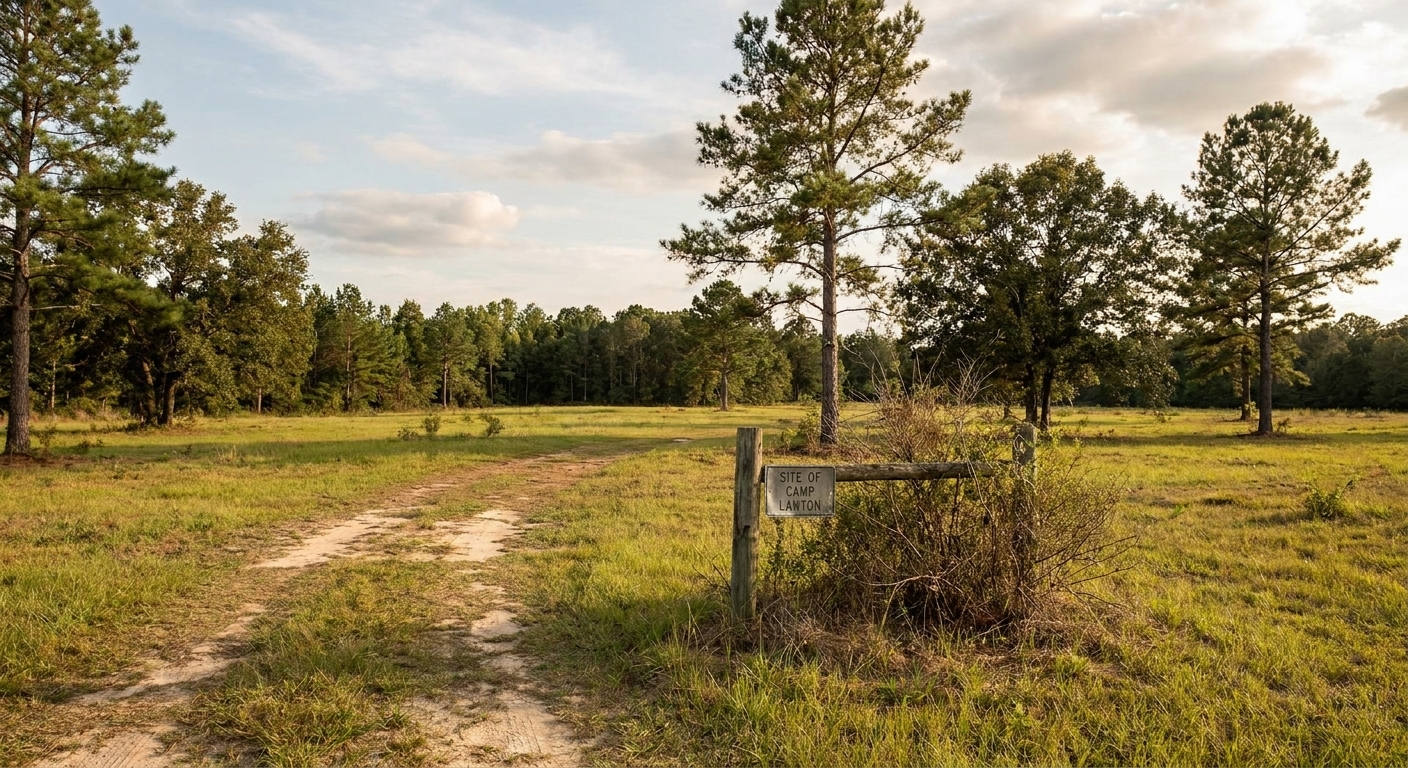
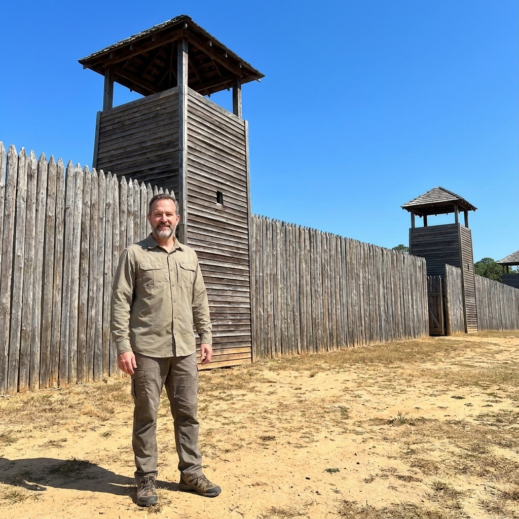
Millen is worth a stop for a specific reason, and it is better to name it plainly than to speak in fog. Just outside town was Camp Lawton, a Confederate prisoner-of-war camp constructed in 1864 as pressure mounted on the overcrowded system elsewhere. It was in operation only briefly before the Confederates evacuated it as Sherman’s columns closed in on the region. In other words, this is not a “battlefield stop” in the usual sense, and it is not a place where Sherman fought. It is a place where the collapse of Confederate logistics shows up in a single, grim footprint.
On-the-ground tip: When you are in this rail-and-pine landscape, look for how flatness and track corridors control movement. Prison history and rail history are tangled together here, because both depended on transport and supply.
This is also a good point on the drive to remember Andersonville, even though it lies southwest of the March to the Sea corridor. When you tour Georgia Civil War history, prison history has a way of entering the conversation. If you want that sobering context before or after your trip, I cover it here: Andersonville and Elmira: The Harsh Reality of Civil War Prisons.
Practical pacing: The Millen area often works best as a pass-through stop on a longer driving day, with an overnight farther east if you want an easier run to the coast.
Stop 7: Ogeechee approaches
As you push east, waterways start to shape the story more and more. Rivers forced choices. Bridges and fords became chokepoints. The Ogeechee River corridor matters because it leads your imagination toward the final objective: Savannah and the coast.
What to notice:
- Bottomland terrain. It is harder to move and easier to defend, and it can feel deceptively quiet today.
- Bridge sites. Even when the original structure is long gone, the location can still teach you why engineers and cavalry were so valuable on this march.
On-the-ground tip: When you reach a river or swampy creek line, get out and walk a short, safe stretch along the shoulder or a nearby path. Feel the humidity, the softness of the ground, the way sightlines shorten. It is a small effort that makes “approaches to Savannah” feel like more than a phrase.
Stop 8: Fort McAllister
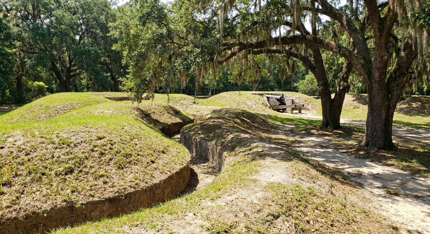
If you only have time for one stop near the end of the route, make it Fort McAllister. This is where the march’s inland violence meets the coastal war. On December 13, 1864, Union forces assaulted and captured the fort, opening communication with the U.S. Navy and tightening the noose around Savannah.
Fort McAllister is valuable because it still looks and feels like a place built to be fought over. Earthen works have a way of surviving when brick and timber do not. Walk the lines slowly and imagine what it meant to charge into a confined space under fire. The march had plenty of destruction without set-piece battles. Fort McAllister is a sharp exception that helps you understand the stakes.
Practical note: This is a state park site. Conditions, hours, and fees can change season to season, so check current details before you build your day around it.
What to do there: Walk the full perimeter of the earthworks. Look for angles of fire. Picture the assault from the attacker’s low ground and then from the defender’s parapet. The story changes depending on where you stand.
Stop 9: Savannah
Savannah is where the march ends on paper, but the war does not end in the mind. The city’s capture and occupation, and Sherman’s famous message presenting Savannah as a “Christmas gift” to Lincoln, have a way of dominating the narrative. When you visit today, I suggest holding two truths together:
- Savannah is a success story of maneuver. The army reached the sea, linked with naval support, and demonstrated the Confederacy’s vulnerability.
- Savannah is also a story of people caught in between. Enslaved families, free Black residents, refugees, and civilians all had their lives reshaped by the occupation and the policies that followed.
On-the-ground tip: Spend time along the riverfront to think about logistics. Ports are about control, supply, and communication. Savannah’s value was never just symbolic.
3 to 5 day itinerary
Option A: 3 days
- Day 1: Atlanta context and monuments, then push east and overnight around Madison.
- Day 2: Milledgeville, then rural stops on the eastward push, ending the day near the Millen corridor.
- Day 3: Fort McAllister, then Savannah.
Option B: 5 days
- Day 1: Atlanta Campaign context, slower start out of the city.
- Day 2: Madison and nearby towns, then overnight around Milledgeville.
- Day 3: Milledgeville deeper walk, then an unhurried drive through the countryside that fed the march.
- Day 4: Millen area context, then position yourself closer to the coast for an easier morning run to Fort McAllister.
- Day 5: Fort McAllister and Savannah with time to walk, not just drive.
For practical travel considerations like pacing, packing, and keeping everyone engaged when attention spans fade in the afternoon heat, I keep more field-tested advice in our travel guide hub: Guide to Battlefield Travel.
What to look for anywhere
- Rail lines and depots: Even when the original station is gone, the rail corridor shows you why a town mattered.
- Courthouse squares: They were the stage where occupation became visible.
- Water crossings: Rivers tell you where speed mattered and where delays could invite resistance.
- Earthworks: They are the closest thing to a time machine we get in the Civil War South, especially in coastal Georgia.
- Interpretation that includes civilians and enslaved people: If a site only talks about generals, it is giving you a narrow slice of the story.
Reading the march through people
On long drives between towns, I like to read a few primary accounts aloud, just a paragraph here and there. Soldier letters, diaries, and postwar recollections can be blunt, funny, ashamed, proud, and contradictory, sometimes all in a single page. If you are interested in getting more out of those sources, start here: Decoding Civil War Soldier Letters.
It also helps to remember that the march was not only blue columns and burning ties. It was also women managing households under threat, and enslaved people making decisions under impossible pressure. For more on civilian improvisation under wartime scarcity, see: Surviving the Home Front: 5 Civil War Substitutes for Daily Goods.
FAQ
Can I follow Sherman’s exact route?
Not as a single continuous path. The army moved in a wide front, routes varied by corps and day, and modern development has erased or rerouted many alignments. What you can do is follow the campaign’s spine by visiting key towns, rail corridors, and coastal objectives, then use markers and local interpretation to fill in the details.
Is Fort McAllister worth it?
Yes. Fort McAllister is one of the few places where you can stand inside surviving fortifications directly tied to the march’s finale. It makes the transition from inland destruction to coastal strategy tangible.
What is the best season for this drive?
Late fall through early spring is hard to beat in Georgia for comfortable walking and clearer sightlines through the trees. I also like winter for battlefield travel in general, and I explain why here: Why Winter Is the Best Time to Visit Civil War Battlefields.